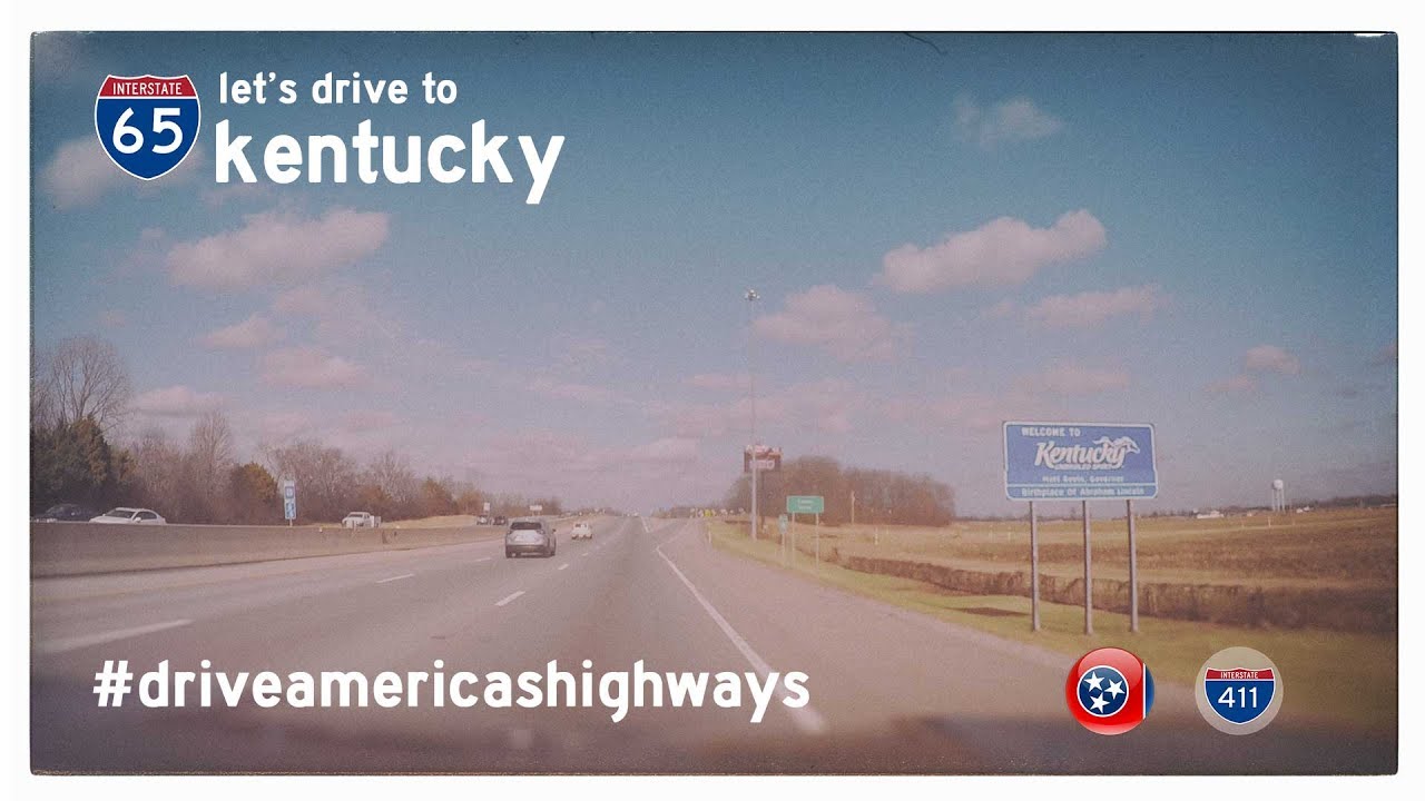
Take a scenic ride into South Central Kentucky as we follow Interstate 65 north from the Tennessee state line to mile marker 29 on the north side of Bowling Green. This 29-mile stretch serves as a key corridor through gently rolling farmland, modest hill country, and the southern gateway to one of Kentucky’s fastest-growing cities. Though it’s part of one of America’s major north-south Interstates, this section of I-65 holds a unique rhythm—equal parts pastoral calm and modern motion.
Our journey begins at the Kentucky-Tennessee border, where the road slips out of the Nashville metro sprawl and into more open terrain. Right away, there’s a sense of change: the tree-lined shoulders widen, the air feels a touch cooler, and the traffic thins just a bit. Franklin, Kentucky appears soon after we cross the line, a city that predates the Civil War and was once a favored dueling ground for Tennessee gentlemen. Today, it’s a thriving community known for its blend of Southern charm and quiet commerce. The interchanges at U.S. Highway 31W and Kentucky Highway 100 offer access to local industries and downtown Franklin, which still retains its classic courthouse square and small-town flavor.
Leaving Franklin behind, I-65 stretches into the rural heart of Simpson County, with long straightaways framed by green pastures, scattered barns, and the occasional silo rising above the tree line. This is tobacco country, though corn and soybeans now dominate the fields. The road itself feels smooth and relaxed here, with the gentle rise and fall of the landscape offering a welcome rhythm. A few clusters of trees mark creek beds and property lines, but mostly this segment is wide open—a showcase of South Kentucky’s agricultural roots and understated beauty.
As we approach Warren County, the mood subtly shifts again. The highway picks up steam as it begins to hint at the larger urban area ahead. Exit 20 brings us to the William H. Natcher Parkway—now signed as Interstaet 165—a vital connector to Owensboro and the western reaches of the Commonwealth. This interchange also marks our entry into the greater Bowling Green area. The tree canopy thickens briefly, commercial development begins to crop up near the interchanges, and the road shoulders widen to accommodate higher traffic volumes.
Bowling Green isn’t just another town on the Interstate; it’s a hub of regional pride and economic significance. Home to Western Kentucky University and the assembly plant for the Chevrolet Corvette, this city wears its gearhead credentials proudly. That pride becomes tangible at Exit 28, where KY-446 splits eastward toward the National Corvette Museum—a shrine to America’s sports car that draws visitors from around the world. The sleek architecture of the museum stands out against the landscape, a modern beacon at the edge of town.
We conclude our drive just beyond this exit, at mile marker 29, where the highway begins its arc around the north side of the city. Here, the traffic often thickens with local and through-travelers alike, and the sound of the road hums with purpose. It’s a fitting end to this segment—a bridge between rural past and urban future, framed by the enduring pulse of the open road.
🎵 Music:
Smooth Sailing w/ Guitar by Audionautix is licensed under a Creative Commons Attribution license (https://creativecommons.org/licenses/by/4.0/)
Artist: http://audionautix.com/
🗺️ Route Map
0 Comments